People Are Trading Perfect Resorts For Places That Feel Almost Unreal—25 “Mystic Outlands” Worth Getting Lost In

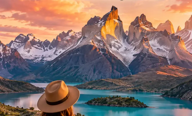
Some places are beautiful in the expected way: blue water, clean sand, nice hotel, excellent breakfast buffet. Then there are places that make your brain quietly ask whether Earth is supposed to look like this.
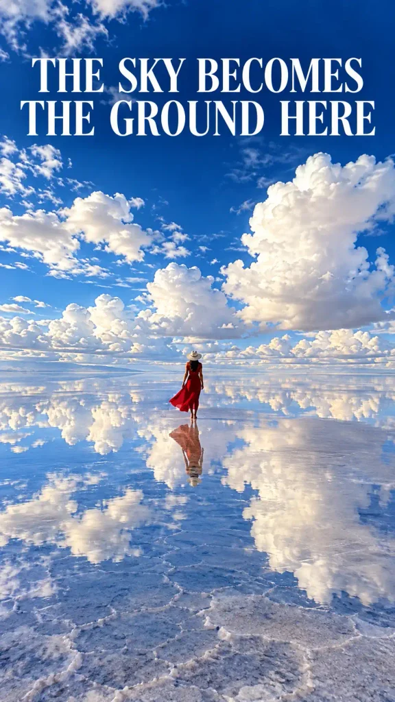
A salt flat becomes a second sky.
Thousands of stone pillars rise out of mist like a city nobody built.
A river turns red beneath clear water. Monasteries sit on sandstone towers. White dunes fill with blue lagoons. A spiral staircase disappears into the ground as if somebody designed a secret level beneath Portugal.
These are the places that make polished resorts feel almost beside the point.
Pinterest’s travel trend research has grouped this appetite for surreal landscapes, misty ruins, strange geology and storybook scenery under a fitting name: “Mystic Outlands.” But the appeal is older than any trend label. Humans have always been drawn to landscapes that make familiar rules feel temporarily unreliable.
The important part is that the places below are not fantasy backdrops. They are real environments shaped by geology, water, wind, climate, history and human culture—and the reality is often stranger than the filtered version.
Travel reality check: “Worth getting lost in” is metaphorical. Several places below involve cliffs, deserts, remote trails, caves, high altitude or tightly managed protected areas. Access rules, weather, conservation closures and safety conditions can change. Always check the destination’s official site shortly before a trip, stay on permitted routes and use required local guides where applicable.
Here are 25 corners of the planet that look as though somebody turned the realism setting down.
1. Salar de Uyuni, Bolivia — Where The Ground Can Turn Into The Sky
There are landscapes that look big, and then there is Salar de Uyuni.
Bolivia’s immense salt flat stretches across roughly 10,000 square kilometers. For much of the year it is a blinding white crust cut into geometric salt patterns. When a shallow layer of water spreads across parts of the surface during wet conditions, the horizon can nearly disappear.
NASA describes the Salar as the world’s largest salt flat and notes that seasonal water can create its famous mirror-like appearance. That is the part photographs struggle to explain: the effect is not simply “a reflection.” When the air is still enough, sky and ground seem to fuse, leaving people and vehicles apparently suspended between two cloud layers.
The mirror is not guaranteed. Weather is in charge here, not your itinerary.
And that unpredictability is part of why the place feels so unreal. On one visit it can resemble a giant sheet of porcelain. On another, it can look like the planet forgot to draw a horizon.
What makes it strange: an enormous white salt crust that can become a near-seamless sky mirror.
Reality check: the mirror effect depends on water and weather; do not treat heavily edited photos as a promise.
Verified by: NASA Earth Observatory.
2. The Faroe Islands — Where Villages Look Borrowed From Folklore
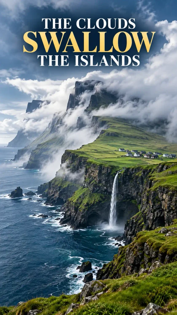
The Faroe Islands do not need special effects. They already have vertical sea cliffs, turf-roofed houses, waterfalls, narrow fjords, crooked peaks and weather that can erase half the view while you are still looking at it.
The official tourism board describes the islands as a place of dramatic North Atlantic cliffs and rapidly changing light. It also warns that fog, wind and rain can change hiking conditions quickly—which is useful context, because the same weather that makes the landscape look mythical is also what makes it demand respect.
One of the Faroe Islands’ visual tricks is scale. A village can sit tiny beneath a mountain wall. A waterfall can seem to drop directly toward the ocean. From certain viewpoints around Sørvágsvatn, perspective can make the lake appear to float high above the sea even though the optical effect is more complicated than the viral photos suggest.
This is not a destination that needs you to hunt constantly for “the shot.” The atmosphere is already doing most of the work.
What makes it strange: sheer cliffs, turf-roofed settlements, ocean weather and constantly shifting visibility.
Reality check: official guidance warns against hiking in poor visibility and close to cliff edges.
Verified by: Visit Faroe Islands.
3. Glencoe, Scotland — A Valley Built By Fire And Ice
Glencoe has the kind of landscape that makes even bad weather look like production design.
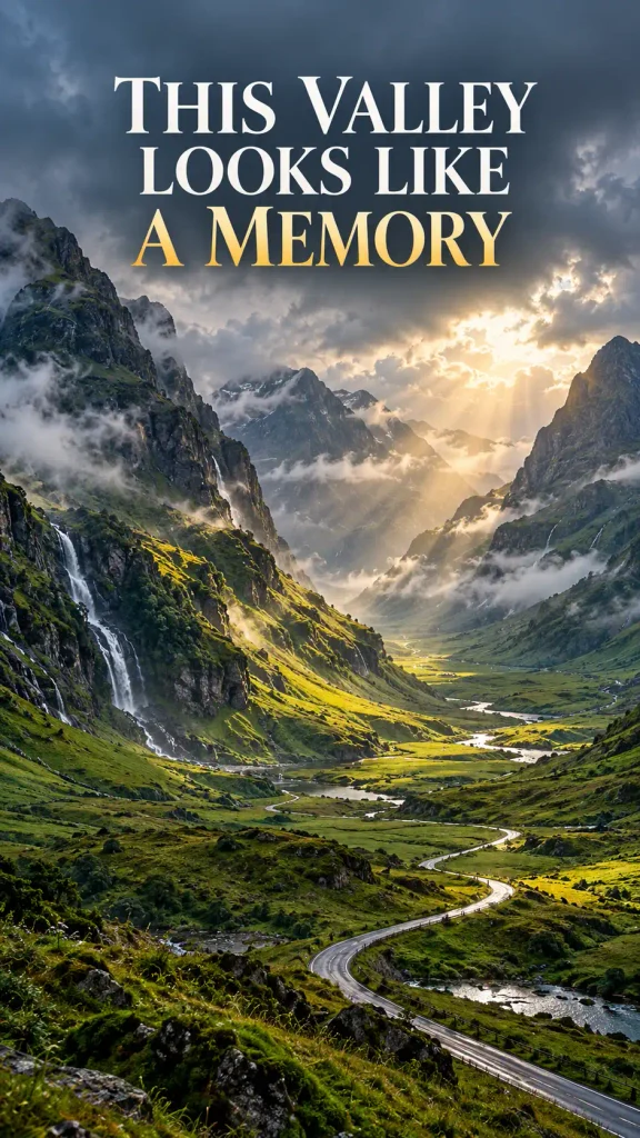
VisitScotland notes that the deep glen and surrounding mountains were shaped over immense spans of time by volcanic activity and glaciers. Today, steep ridges close around the road while cloud sits low enough to brush the slopes.
What makes the place feel mystical is not one spectacular object. It is the layering.
Dark mountain. Bright strip of grass. Waterfall. Mist. Another mountain appearing behind the first. Then a patch of sun moves across the whole thing and the scene changes before you have decided how to photograph it.
The landscape also carries human history, including the infamous Glencoe massacre, so reducing it to “moody aesthetic” misses part of its weight.
This is scenery with atmosphere and memory at the same time.
What makes it strange: a deep glacial valley enclosed by massive, weather-darkened mountains.
Reality check: mountain conditions can change quickly; scenic does not mean gentle terrain.
Verified by: VisitScotland.
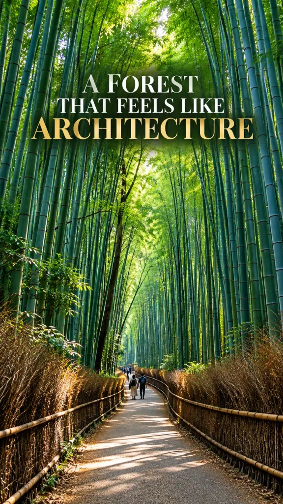
4. Arashiyama Bamboo Grove, Japan — A Forest Made Of Vertical Lines
Arashiyama’s bamboo grove looks almost too orderly to be alive.
Tall blue-green culms rise close together on either side of the path, turning the forest into a repeating pattern of vertical lines. Light filters through high leaves rather than a conventional broad canopy, so the scene can feel more like architecture than woodland.
Kyoto’s official travel guide describes Arashiyama as one of the city’s most popular areas—and that is important context. The dreamy empty walkway you have seen online is not the default experience. It can be busy.
That does not make the bamboo less impressive. It simply means the real version includes other people who also saw the same photograph.
Kyoto also asks visitors not to carve into bamboo stalks. Damaged bamboo cannot simply heal back into its original condition.
Mystical scenery still needs ordinary good manners.
What makes it strange: immense repetition of tall bamboo creates an almost built environment from living plants.
Reality check: this is a highly visited site; respect the grove and manage expectations around crowds.
Verified by: Kyoto City Official Travel Guide.
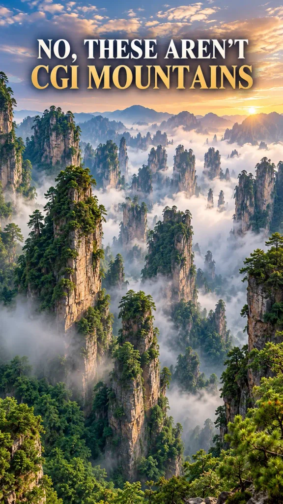
5. Wulingyuan, China — More Than 3,000 Stone Towers In The Mist
If Wulingyuan looks like a landscape artist kept adding rock pillars because nobody stopped them, the numbers explain why.
UNESCO describes more than 3,000 narrow quartz sandstone pillars and peaks across this area of Hunan, many rising over 200 meters. Ravines, streams, waterfalls, caves and natural bridges fill the gaps between them.
Then the clouds arrive.
UNESCO specifically notes how mist frequently shrouds the peaks, and that is when the landscape seems least attached to gravity. Pillars emerge in layers—sharp foreground columns, faint middle-distance towers, then pale silhouettes dissolving into cloud.
Zhangjiajie National Forest Park sits within this wider Wulingyuan landscape, which is why the names are often used loosely in travel posts.
Whatever label is on the map, the visual experience is the same: a forest where some of the “trees” are stone.
What makes it strange: thousands of extremely narrow sandstone pillars rising through dense forest and cloud.
Reality check: mist makes the scenery magical but can also hide views completely.
Verified by: UNESCO World Heritage Centre.
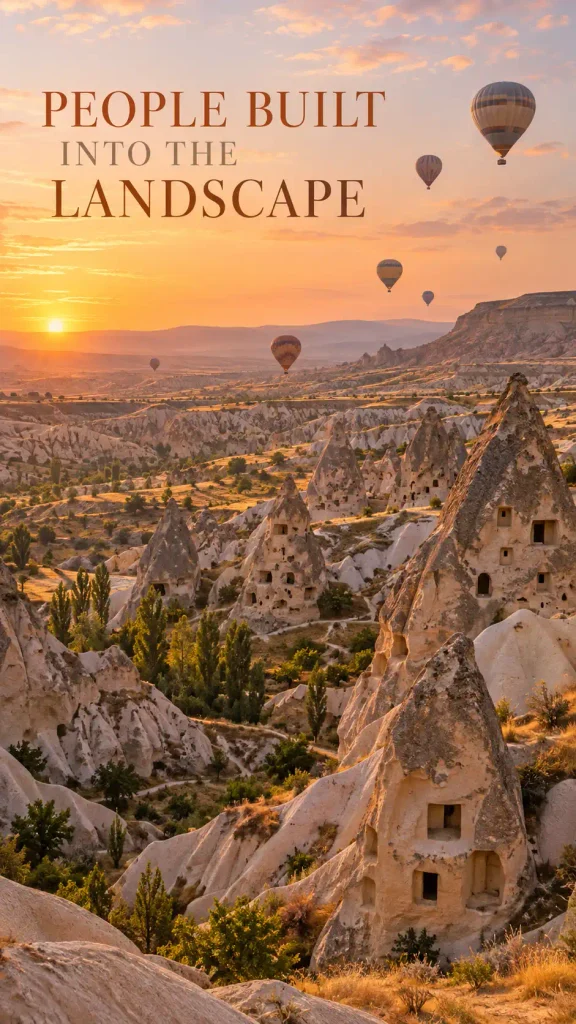
6. Cappadocia, Türkiye — A Landscape That Humans Moved Inside
Cappadocia would already be strange if nobody had ever lived there.
Its volcanic landscape was eroded into cones, ridges, valleys and slender formations commonly called fairy chimneys. Then people carved churches, dwellings and entire underground settlements into and beneath the rock.
UNESCO describes Göreme and the surrounding rock sites as a landscape sculpted by erosion and deeply intertwined with centuries of human settlement.
That combination is what makes Cappadocia more compelling than “the place with hot-air balloons.”
A cone is not merely a cone when somebody once carved a room into it.
A cliff is not merely geology when openings in the stone reveal homes and sanctuaries.
The balloons are beautiful. The landscape beneath them is the actual story.
What makes it strange: erosion-built “fairy chimneys” combined with rock-cut architecture and underground settlements.
Reality check: balloon flights are weather-dependent; Cappadocia is worth understanding from ground level too.
Verified by: UNESCO World Heritage Centre.
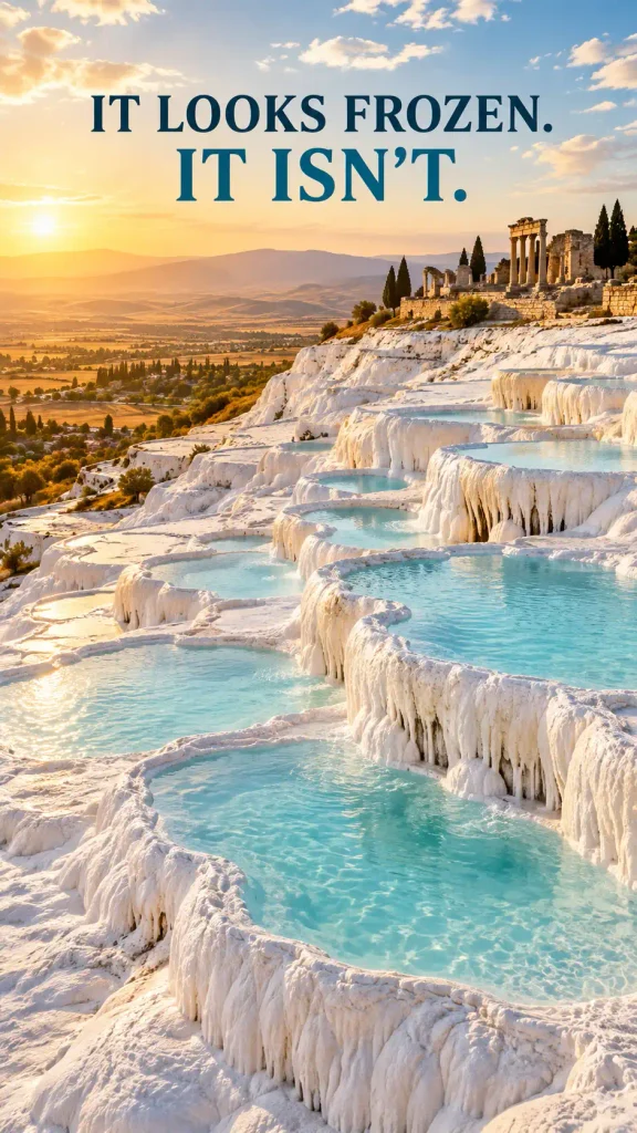
7. Pamukkale, Türkiye — The Cliff That Looks Covered In Snow But Isn’t
From a distance, Pamukkale can look like a mountainside caught in permanent winter.
Up close, the white surface is mineral.
UNESCO explains that calcite-rich thermal waters flowing from springs have created terraces, basins, petrified cascades and bright calcium carbonate deposits down the hillside. The name Pamukkale is commonly translated as “cotton castle.”
The landscape becomes even stranger because the ruins of ancient Hierapolis sit above it.
White terraces. Blue thermal water. Columns. Theatre. Necropolis.
It is geology and archaeology occupying the same frame.
Visitors cannot simply walk everywhere they want across the travertines; access is managed to protect the formations and water flow. That is a useful reminder that the surreal white surface is not decorative flooring.
What makes it strange: dazzling white mineral terraces formed by flowing thermal water.
Reality check: access to the travertines is controlled for conservation; follow designated visitor routes.
Verified by: UNESCO World Heritage Centre.
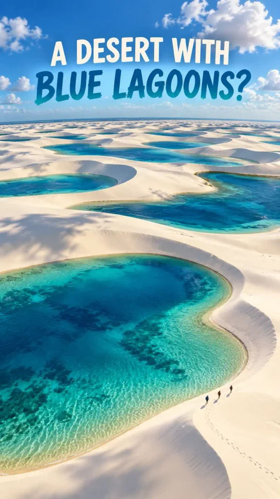
8. Lençóis Maranhenses, Brazil — A “Desert” That Fills With Lagoons
At first glance, Lençóis Maranhenses looks like a giant white-sand desert.
Then you notice all the water.
UNESCO describes an enormous coastal dune field in northeastern Brazil where rainfall creates temporary and permanent lagoons between the dunes. During the wetter part of the natural cycle, blue and green water collects in the troughs between sweeping white ridges.
The result is a landscape that seems to have mixed two environments that were supposed to stay separate.
Dune. Lagoon. Dune. Lagoon.
And because both the dunes and water levels change, the scene is not static. The landscape you imagine from one photograph may not exist in exactly that form when you arrive.
That is not a flaw. It is the reason the place exists.
What makes it strange: vast white coastal dunes interspersed with rain-fed lagoons.
Reality check: lagoon conditions are seasonal and variable; research timing before making them the entire reason for a trip.
Verified by: UNESCO World Heritage Centre.
9. The Namib Sand Sea, Namibia — A Desert Fed By Fog
The Namib looks like the definition of dryness, which makes one of its defining ecological facts wonderfully contradictory.
Fog matters here.
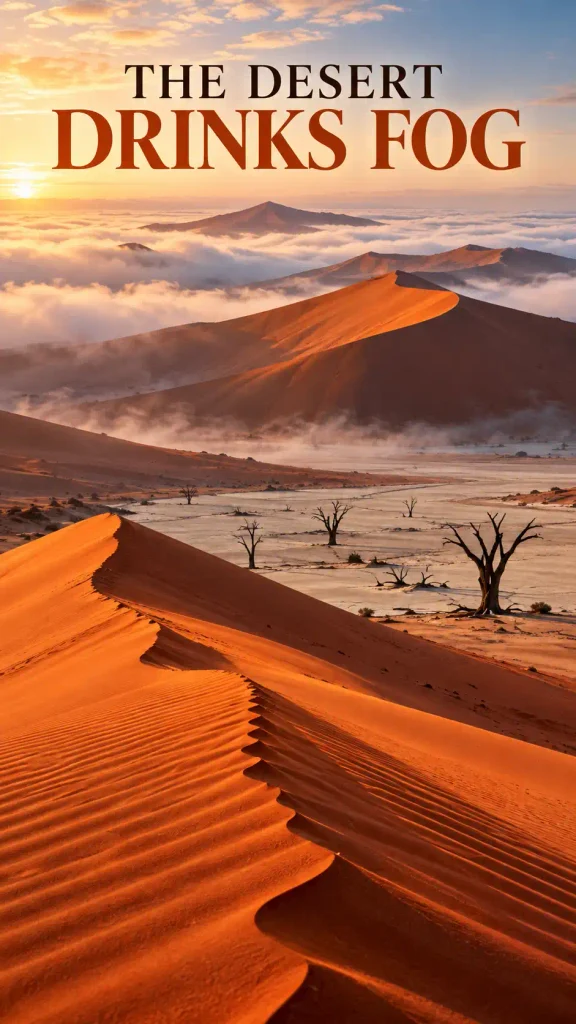
UNESCO describes the Namib Sand Sea as the world’s only coastal desert with extensive dune fields influenced by fog. That fog provides crucial moisture in an environment where conventional rainfall is scarce.
Visually, the dunes already feel unreal: enormous rust-orange slopes, sharp shadow lines, flat pale pans and skeletal trees in places such as Deadvlei.
Then coastal fog drifts into the system and makes the desert feel even stranger—less like an empty furnace and more like a moving atmospheric machine.
This is not dead scenery. It is an extreme environment with organisms adapted to extracting opportunity from almost nothing.
What makes it strange: immense shifting dunes in a coastal desert where fog is a major water source.
Reality check: desert heat and distance are serious logistical factors; plan with established local guidance.
Verified by: UNESCO World Heritage Centre.
10. Wadi Rum, Jordan — A Desert That Makes People Reach For The Word “Mars”
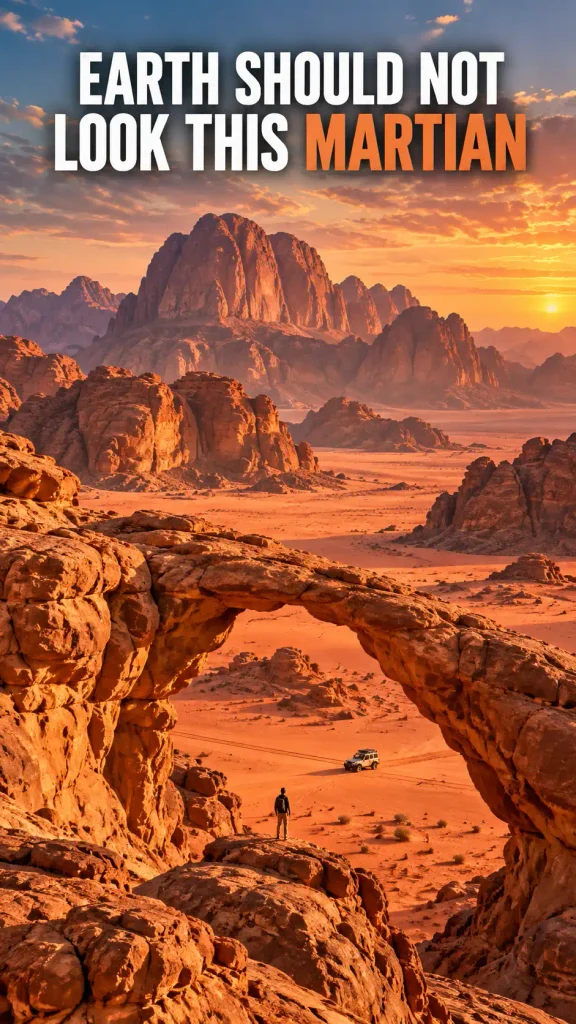
Wadi Rum gets compared to another planet so often that the comparison has almost become a cliché.
Then you see the scale of the place.
UNESCO describes a landscape of sandstone mountains, enormous valleys, narrow gorges, arches, cliffs and caverns across southern Jordan. It is also a cultural landscape with thousands of rock carvings and inscriptions documenting long human interaction with the desert.
The mistake is thinking Wadi Rum is “empty.”
It contains geological stories, archaeological evidence and living Bedouin culture. The silence may feel cinematic, but people have been navigating and understanding this environment for thousands of years.
The surreal part is not that the desert resembles Mars.
It is that it is unmistakably Earth, once you know what you are looking at.
What makes it strange: huge sandstone massifs, arches and broad red desert valleys at monumental scale.
Reality check: respect the protected landscape and the local communities whose cultural history is part of the site.
Verified by: UNESCO World Heritage Centre.
11. Meteora, Greece — Monasteries Suspended Above The Plain
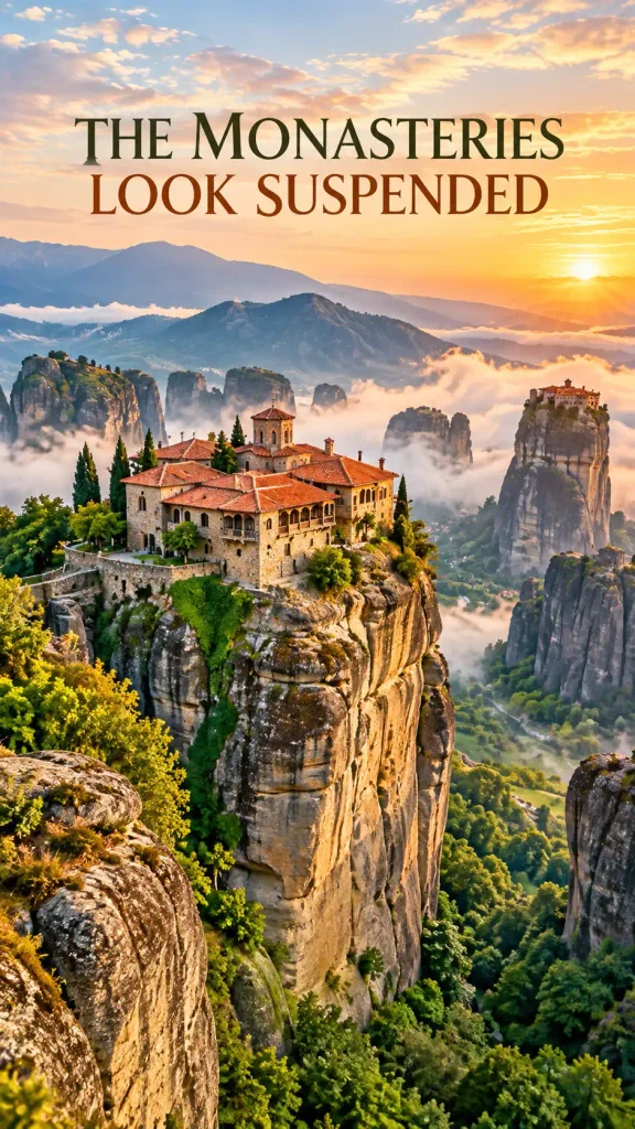
Meteora looks like two separate improbable ideas placed on top of each other.
First: enormous sandstone pillars rising abruptly from central Greece.
Second: monasteries built on their summits.
UNESCO notes that monks began settling among these “columns of the sky” from around the 11th century, with monasteries later constructed on peaks that were once extraordinarily difficult to reach.
The architecture does not dominate the geology. It seems to negotiate with it.
A red roof appears at the edge of a vertical drop. Stone walls continue the color of the cliff beneath them. Mist hides the base of a pillar and for a moment the monastery genuinely appears suspended.
It is one of the rare places where “how did they even build that?” remains a completely reasonable reaction no matter how much history you read.
What makes it strange: historic monasteries positioned atop gigantic sandstone pillars.
Reality check: these are living religious and heritage sites, not merely photo props; dress and behave accordingly.
Verified by: UNESCO World Heritage Centre.
12. Plitvice Lakes, Croatia — Water That Keeps Rebuilding The Landscape
Plitvice does not give you one waterfall.
It gives you an entire system that seems to have forgotten how to stop making them.
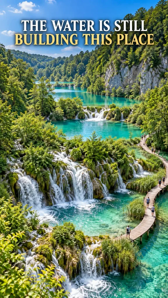
UNESCO explains that water flowing through limestone and chalk deposits travertine, creating natural barriers. Those barriers form lakes, cascades, caves and new channels—and the geological process is still active.
That detail changes the way the place feels.
You are not simply looking at a finished landscape. The water is helping construct it.
Wooden walkways pass above clear pools while forest presses close around turquoise and green water. In photographs, it can look like somebody turned saturation too high. In reality, mineral conditions, depth, light and surrounding vegetation all affect the color.
The magic is chemistry and geology doing their jobs.
What makes it strange: interconnected lakes and waterfalls separated by naturally growing travertine barriers.
Reality check: stay on designated routes; protected water systems are not freestyle swimming pools.
Verified by: UNESCO World Heritage Centre.
13. Waitomo, New Zealand — A Cave Ceiling That Looks Like A Night Sky
You enter underground expecting darkness.
Instead, the ceiling has stars.
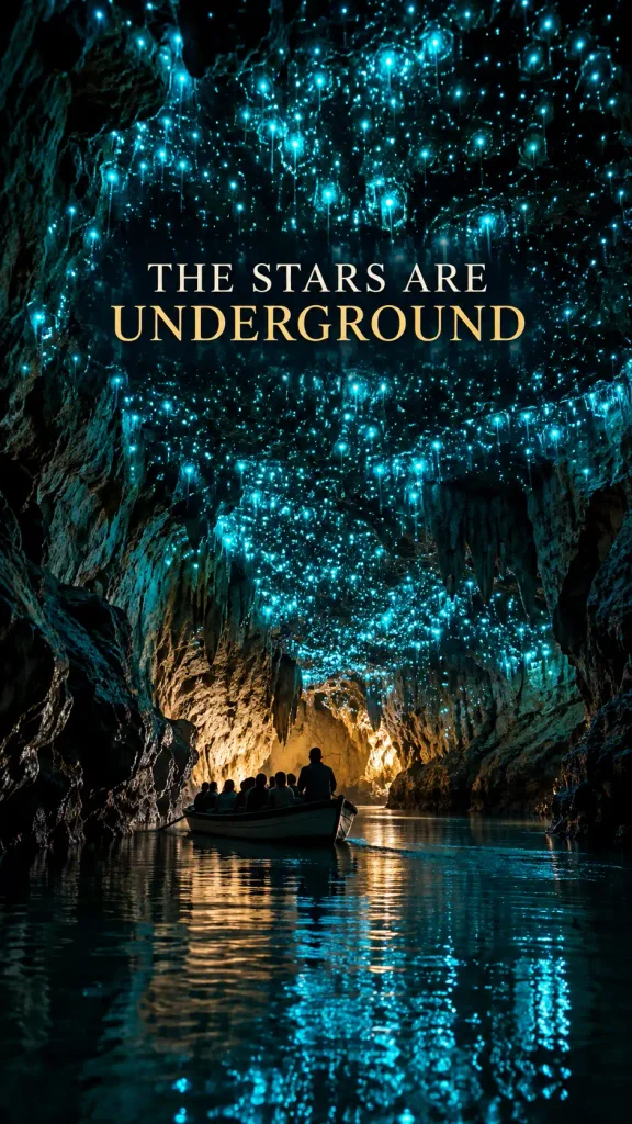
Tourism New Zealand describes the Waitomo region as a vast limestone cave network whose most famous attraction is its glowworms. The light comes from larvae that produce bioluminescence, creating thousands of tiny blue-green points above dark cave passages.
The effect is powerful because the scale is hard to read.
Without the usual daylight cues, a cave ceiling covered in glowworms can feel impossibly distant—less like rock overhead and more like a sky you somehow reached from below.
Different cave experiences have different rules, and some areas tightly control photography and visitor movement. That is good. Darkness, humidity and fragile cave environments do not exist solely for our camera rolls.
What makes it strange: bioluminescent glowworms create a star-field effect inside limestone caves.
Reality check: follow each cave operator’s rules on photography, lighting and movement.
Verified by: Tourism New Zealand.
14. Giant’s Causeway, Northern Ireland — 40,000 Stone Columns That Look Manufactured
If you had never heard the geological explanation, “a giant built it” would at least be visually understandable.
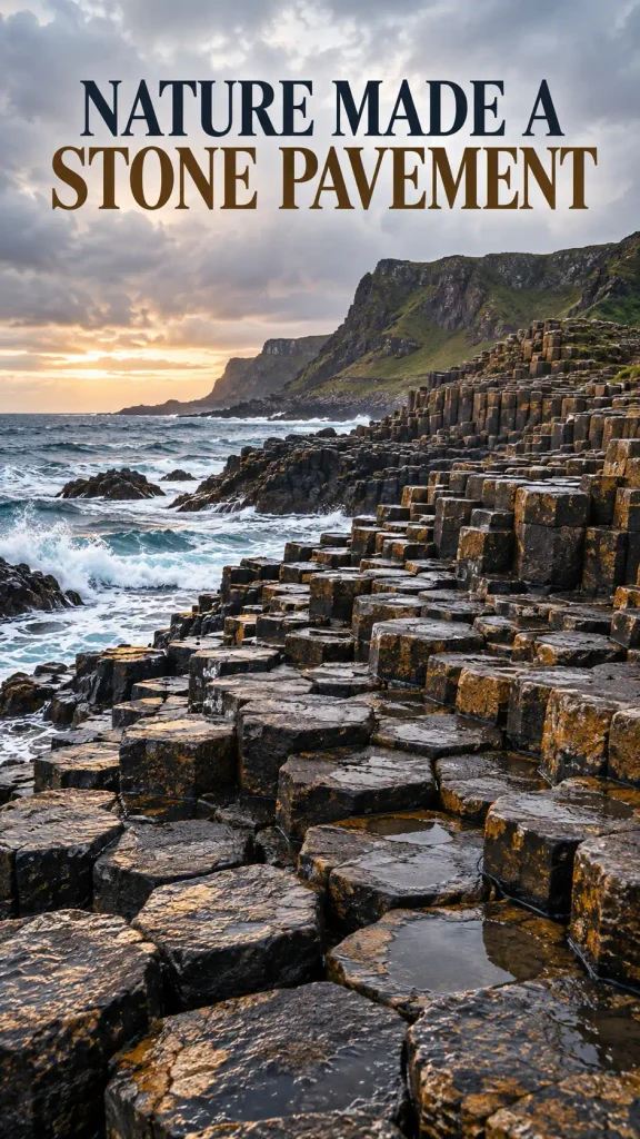
The Giant’s Causeway contains around 40,000 interlocking basalt columns, many with strikingly regular polygonal shapes. UNESCO traces the formation to volcanic activity roughly 50–60 million years ago.
Standing among the columns, the weirdness comes from repetition.
Natural rock usually looks irregular enough to reassure us that nobody measured it. Here, columns fit together like a pavement, stepping down toward the sea.
That uncanny regularity helped inspire legends of giants and has also made the site important to the history of geological study.
Sometimes folklore and science start from the exact same reaction:
What on earth happened here?
What makes it strange: tens of thousands of naturally formed polygonal basalt columns arranged like constructed paving.
Reality check: wet coastal rock is slippery and waves are not interested in your composition.
Verified by: UNESCO World Heritage Centre.
15. White Sands, New Mexico — A Desert That Looks Like Fresh Snow
White Sands causes an immediate category error.
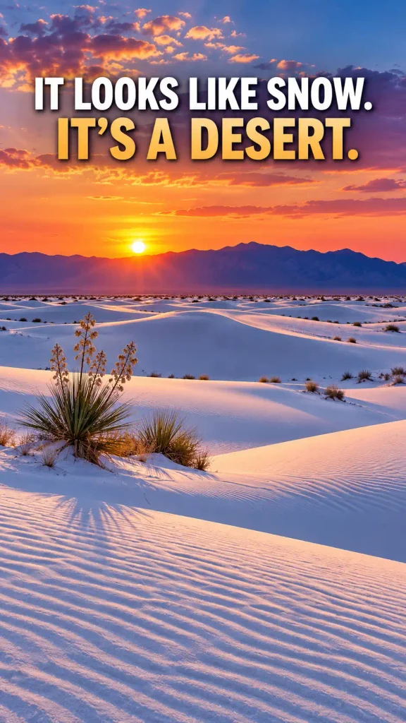
Your eyes say snow.
The temperature and footprints say desert.
The U.S. National Park Service describes a 275-square-mile gypsum dunefield—the largest of its kind in the world. Gypsum is unusual as dune sand because it dissolves readily in water, yet a particular combination of geology, hydrology and climate allows these bright white dunes to persist.
The whiteness also changes the quality of light. Shadows can turn blue. Sunset brings pink and violet tones. A cottonwood or yucca can look absurdly isolated against a clean white slope.
It is one of the easiest places to understand the phrase “otherworldly” without needing any dramatic rock formation at all.
What makes it strange: a vast active desert dune field made of brilliant white gypsum sand.
Reality check: desert exposure is still desert exposure; bring water and check park alerts before visiting.
Verified by: U.S. National Park Service.
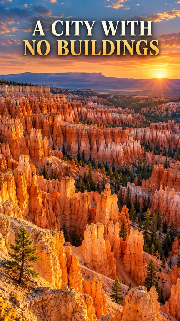
16. Bryce Canyon, Utah — The World’s Greatest Crowd Of Hoodoos
Bryce Canyon is less like a canyon and more like a stone audience waiting for something to begin.
The National Park Service says Bryce contains the greatest concentration of hoodoos on Earth. These tall, thin rock spires form through a long combination of deposition, uplift, weathering and erosion, with freeze-thaw processes helping break the rock into the shapes visible today.
At sunrise, the hoodoos catch light unevenly, and thousands of orange and pink spires seem to turn on one row at a time.
The strange part is not any single hoodoo.
It is the crowd.
One spire could be an accident. Thousands begin to feel like a city with no streets.
What makes it strange: enormous amphitheaters packed with tall erosion-sculpted hoodoos.
Reality check: Bryce sits at high elevation; altitude and changing weather can matter even on apparently easy walks.
Verified by: U.S. National Park Service.
17. Antelope Canyon, Navajo Nation — Sandstone That Looks Like Fabric
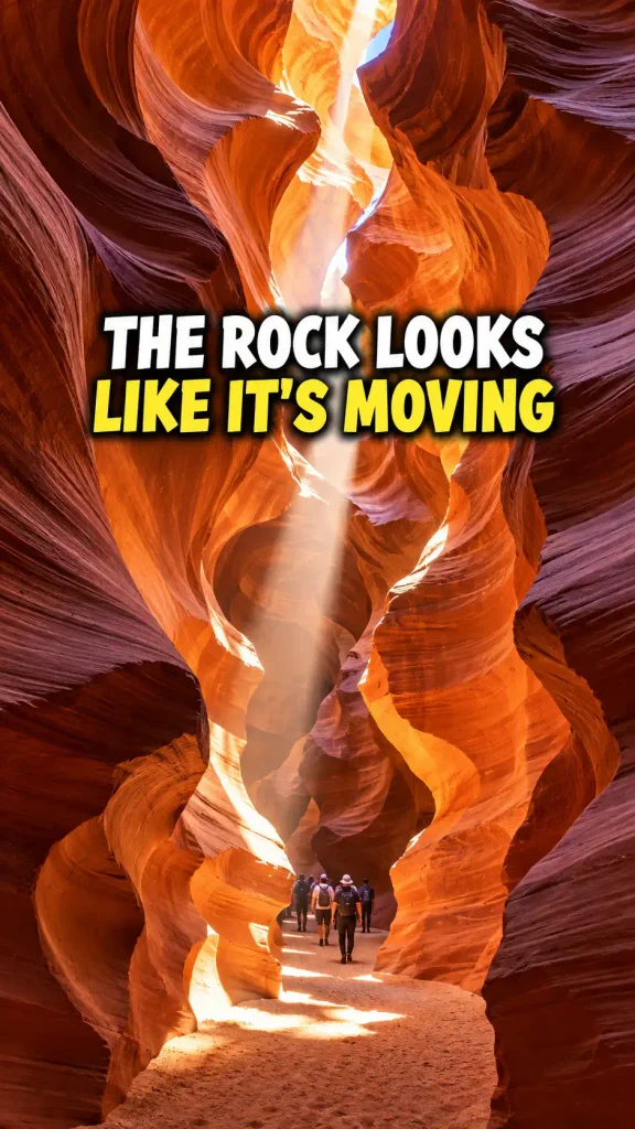
Antelope Canyon is rock behaving in a way rock does not seem entitled to behave.
The narrow sandstone walls fold, curl and sweep overhead like giant pieces of cloth. Light changes the color from orange to red to purple depending on angle and time.
The canyon is located on Navajo Nation land, and the Navajo Nation Parks & Recreation Department states that Antelope Canyon locations are accessible only through guided tours.
That fact should not be treated as a travel inconvenience. It is part of visiting a protected place on Indigenous land responsibly.
Photos often make the canyon look silent and empty. The real experience is guided and managed. The stone, however, is every bit as strange as advertised.
What makes it strange: narrow slot-canyon walls sculpted into smooth flowing sandstone forms.
Reality check: guided tours are mandatory; book through authorized Navajo operators and follow local rules.
Verified by: Navajo Nation Parks & Recreation.
18. Valle de la Luna, Chile — A Moon Landscape With Earth’s Best Sunset Lighting
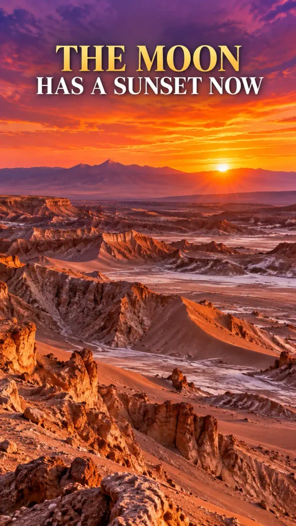
Valle de la Luna does not hide what it is selling. The name literally promises the Moon.
Chile’s official tourism site describes a landscape in the Atacama sculpted by wind and time into dunes, salt formations, ridges and canyon-like terrain. At sunset, the already strange geology shifts through red, violet and gold.
The place does not resemble the Moon scientifically so much as emotionally.
It is dry, exposed, nearly vegetation-free in places, and dominated by rock surfaces that feel unfinished—as if the landscape were still waiting for plants to arrive.
Then the light changes and the entire valley looks less dead than theatrical.
What makes it strange: hyper-arid salt-and-stone terrain with dunes, sharp ridges and extreme color shifts at sunset.
Reality check: sun and dehydration are practical concerns; carry water and follow reserve entry guidance.
Verified by: Chile Travel.
19. The Chocolate Hills, Philippines — Hundreds Of Hills That Look Copied And Pasted
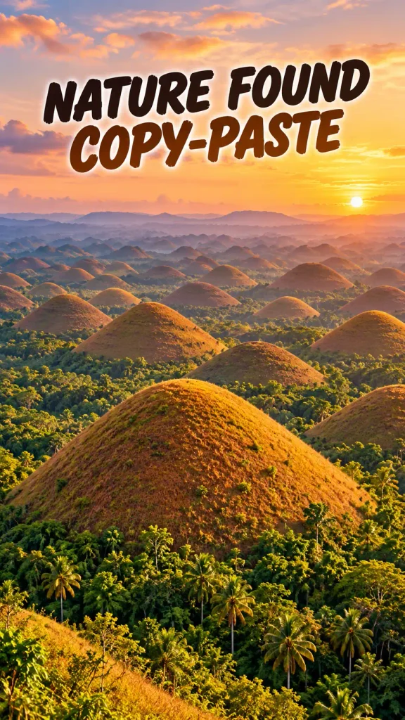
The weirdest thing about Bohol’s Chocolate Hills is not that the hills are brown sometimes.
It is how many of them seem to have agreed on the same shape.
The landscape contains a vast field of grass-covered limestone hills, many rounded or conical enough to look unnervingly consistent. During drier conditions, the grass turns brown and gives the formation its famous name.
The Philippines has designated the Chocolate Hills a National Geological Monument, and the site is also recognized for its unusual karst landscape.
From a viewpoint, the repetition is almost comical.
One dome. Another dome. Another. Then the pattern keeps going toward the horizon until the brain starts wondering whether nature discovered copy-and-paste.
What makes it strange: a broad landscape packed with similarly shaped grass-covered limestone hills.
Reality check: their “chocolate” appearance changes with seasonal vegetation; green hills are not the wrong version.
Verified by: UNESCO tentative-list documentation and Philippine geological designation records.
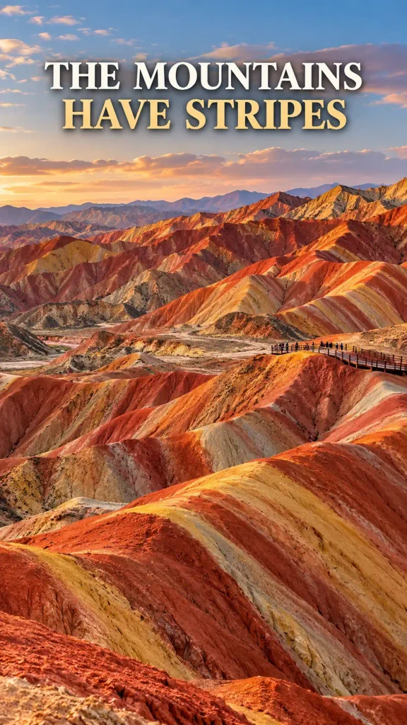
20. Zhangye Danxia, China — Mountains Wearing Stripes
Most mountains seem content with one basic color palette.
Zhangye Danxia did not receive that memo.
This UNESCO Global Geopark in northwestern China is famous for colorful hills where layered rock creates broad bands of red, orange, ochre and other tones across eroded slopes.
The landscape looks painted because the colors follow geological structure rather than vegetation. Ridges fold across one another, and the banding bends with them.
The internet sometimes pushes the saturation of these “rainbow mountains” into cartoon territory, so it helps to expect geology rather than a box of crayons.
The real colors can still be striking—especially under favorable light—but the fascinating part is that those stripes are the mountain.
What makes it strange: erosion exposes strongly colored sedimentary layers across rolling hills and ridges.
Reality check: highly saturated social images can exaggerate the palette; natural light changes what you see.
Verified by: UNESCO Global Geoparks information.
21. Ha Long Bay–Cat Ba, Vietnam — A Seascape Full Of Stone Towers
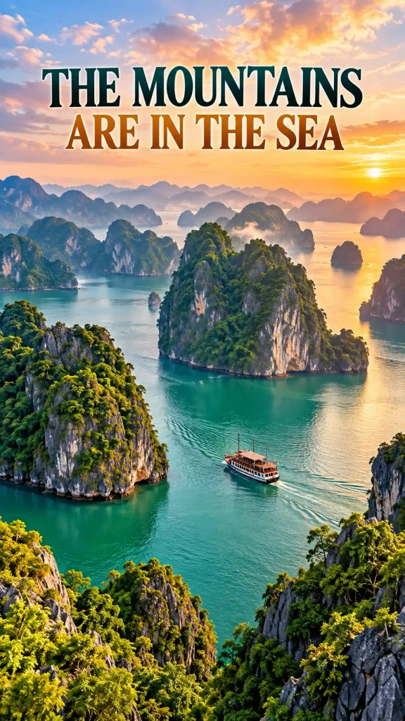
Ha Long Bay looks less like a coastline and more like a mountain range that forgot to stay on land.
UNESCO describes more than a thousand islands and islets across the wider Ha Long Bay–Cat Ba World Heritage property, with limestone towers rising dramatically from the sea.
Karst landscapes already have a habit of producing improbable vertical shapes. Flood them, and the result becomes even stranger.
Forest-covered stone rises straight from green-blue water. Cliffs disappear into haze. Small boats turn into scale markers beneath walls of limestone.
The classic wide view is beautiful, but the enclosed inlets, caves and close passes between towers are what make the geography feel labyrinthine.
What makes it strange: marine-invaded tower karst creates steep limestone islands rising directly from the sea.
Reality check: choose operators that follow local environmental rules; iconic landscapes also face tourism pressure.
Verified by: UNESCO World Heritage Centre.
22. Tsingy de Bemaraha, Madagascar — A Forest Made Of Stone Needles
Tsingy de Bemaraha looks actively hostile to shoes.
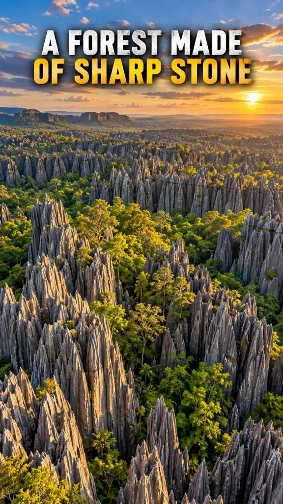
UNESCO describes a spectacular karst landscape cut into a “forest” of sharp limestone pinnacles, with some formations reaching around 100 meters. Canyons and actual forest occupy the spaces between the stone.
The word tsingy is associated locally with the pointed nature of the terrain, and the visual description “forest of sharp stones” is unusually accurate.
Seen from above, thousands of gray blades push upward through green vegetation.
Seen from inside, the landscape becomes narrow passages, ladders, bridges and exposed limestone—depending on the visitor route and local management.
This is one of those places where “otherworldly” should not be mistaken for “easy.”
What makes it strange: immense fields of razor-like limestone pinnacles mixed with canyons and endemic forest ecosystems.
Reality check: access can be physically demanding and remote; use established local operators and park guidance.
Verified by: UNESCO World Heritage Centre.
23. Caño Cristales, Colombia — The River That Turns Red
If you saw a heavily edited photograph of a red river, skepticism would be healthy.
Caño Cristales earns the color more honestly.
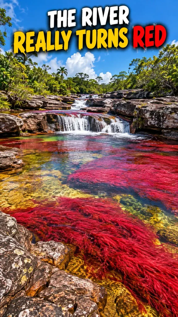
Colombia’s official tourism site explains that the river’s famous reds, greens and other tones are associated with the aquatic plant Macarenia clavigera, visible through the clear water under the right seasonal conditions.
The important phrase is right conditions.
Caño Cristales is not permanently switched into rainbow mode. Water level, sunlight and the plant’s natural cycle affect the show.
When those pieces line up, the riverbed can look like somebody painted broad strokes of crimson under moving water.
The color is alive, which is much more interesting than a filter.
What makes it strange: aquatic plants can create vivid red and multicolored bands beneath clear flowing water.
Reality check: the strongest color is seasonal; access is managed for conservation.
Verified by: Colombia Travel.
24. Quinta da Regaleira, Portugal — A Staircase That Disappears Into The Earth
Not every Mystic Outland has to be natural.
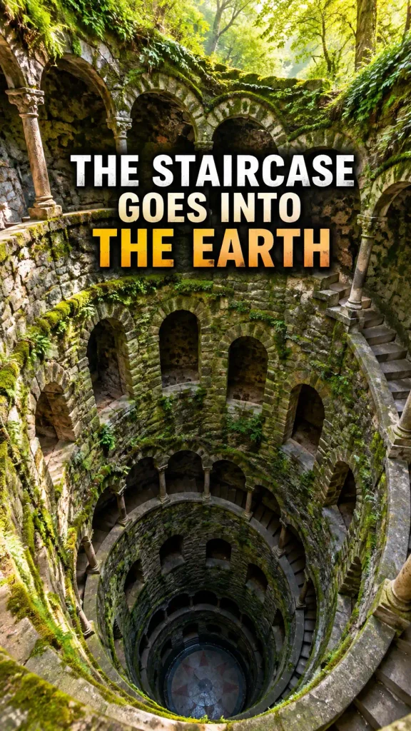
Quinta da Regaleira in Sintra was designed as an architectural landscape full of symbolism, eclectic historic styles, gardens, tunnels and theatrical transitions between above and below ground.
The official foundation credits owner António Augusto de Carvalho Monteiro and Italian architect-stage designer Luigi Manini with creating the estate’s extraordinary late-19th- and early-20th-century ensemble.
Its most famous feature is the Initiatic Well: a deep spiral stairway descending around a circular void before connecting into underground passages.
Calling it a “well” almost undersells the visual experience. It feels more like architecture performing a disappearing act.
One moment you are in a romantic garden. The next, you are spiraling downward through mossy stone.
What makes it strange: a symbolic spiral “well,” grottoes and underground passages embedded inside a Romantic-era estate.
Reality check: visitor circulation through the Initiatic Well and tunnels is regulated; use the official route.
Verified by: Fundação Cultursintra / Quinta da Regaleira.
25. Bisti/De-Na-Zin Wilderness, New Mexico — The Badlands That Look Half-Finished
Bisti/De-Na-Zin is a useful finale because it does not need famous waterfalls, bright colors or a huge entrance monument.
It is simply weird.
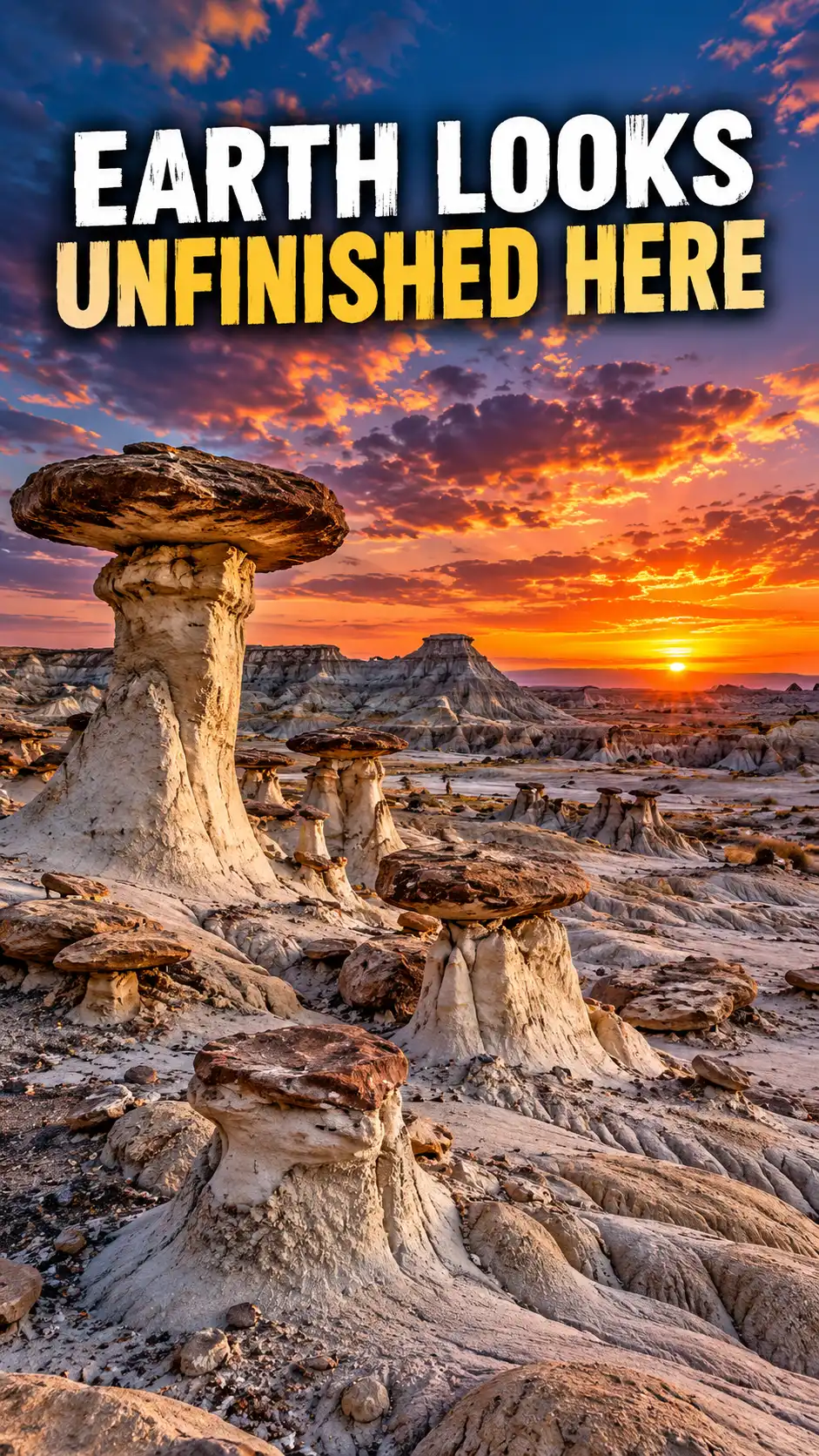
The U.S. Bureau of Land Management describes a remote badlands landscape of sandstone, shale, mudstone, coal and silt weathered into hoodoos, pinnacles, cap rocks and other unusual forms. Fossils and petrified wood also occur in the region.
The shapes have names because humans cannot resist naming strange rocks, but the appeal is bigger than any one formation.
Entire sections of landscape look unfinished: gray clay hills, mushroom-like hoodoos, balanced caps and eroded forms scattered beneath a huge desert sky.
There are also few facilities and limited cell service. In other words, this is one place where “getting lost” must remain strictly a figure of speech.
What makes it strange: erosion has produced a fantasy landscape of hoodoos, cap rocks and fossil-bearing badlands.
Reality check: BLM warns of remote, largely unmarked terrain, limited cell service and no potable water; navigation preparation matters.
Verified by: U.S. Bureau of Land Management.
There is nothing wrong with a perfect resort.
Sometimes you want the pool, the clean sheets, the breakfast somebody else made and a beach that asks absolutely nothing from you.
But these places offer a different kind of travel reward.
They make you look twice.
They force your sense of scale to recalibrate. They make geology feel theatrical, weather feel like part of the architecture, and history feel physically attached to the landscape.
And maybe that is why “unreal” places are so compelling in the first place.
Not because they let us escape Earth.
Because they remind us how strange Earth already is.
Which of these 25 places would you most want to see with your own eyes?
Sources & Further Reading
- Pinterest — Mystic Outlands travel trend research
- NASA Earth Observatory — Salar de Uyuni
- Visit Faroe Islands — Hiking and landscape guidance
- Visit Faroe Islands — Safe hiking guidance
- VisitScotland — Glencoe
- Kyoto City Official Travel Guide — Saga & Arashiyama
- UNESCO — Wulingyuan Scenic and Historic Interest Area
- UNESCO — Göreme National Park and Rock Sites of Cappadocia
- UNESCO — Hierapolis-Pamukkale
- UNESCO — Lençóis Maranhenses National Park
- UNESCO — Namib Sand Sea
- UNESCO — Wadi Rum Protected Area
- UNESCO — Meteora
- UNESCO — Plitvice Lakes National Park
- Tourism New Zealand — Waitomo Caves
- UNESCO — Giant’s Causeway and Causeway Coast
- U.S. National Park Service — White Sands National Park
- U.S. National Park Service — Bryce Canyon geology
- Navajo Nation Parks & Recreation — Antelope Canyon access
- Chile Travel — Valle de la Luna
- UNESCO — Chocolate Hills Natural Monument documentation
- UNESCO Global Geoparks — Zhangye context
- UNESCO — Ha Long Bay–Cat Ba Archipelago
- UNESCO — Tsingy de Bemaraha / Andrefana Dry Forests
- Colombia Travel — Caño Cristales
- Quinta da Regaleira — Official history
- Quinta da Regaleira — Official visitor guidance
- U.S. Bureau of Land Management — Bisti/De-Na-Zin Wilderness